South America Daily Snow

By Luke Stone, Forecaster Posted 1 year ago July 1, 2024
Active Southerly Storm Track
Summary
Snow returned to the Andes on Sunday in the central and southern zones as a very active June came to a close. The storm track will remain over the southern part of the continent over the next week, with several storms bringing more snow to this region. Snow totals won't be overly impressive during any twenty-four-hour period, but conditions will stay soft through much of this week.
Short Term Forecast
The sun came out in the northern zone allowing Portillo and Las Lenas to have great opening weekends with some of the deepest early-season snow depths in decades. After a short break in the central and southern zones, snow returned on Sunday and this mostly dry north, wet central/south pattern will continue through the middle of the week. Below are a few shots from Chapelco on Sunday.


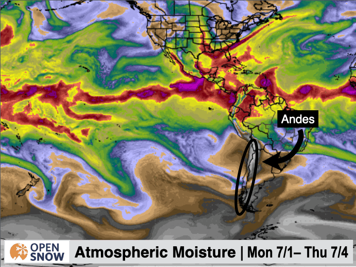
Several systems will track through the southern part of the continent keeping the chances for snow alive through Thursday, with some solid snow totals and even better than that in some locations. The totals won't be anything like some of the major storms we've seen in the last few weeks, as the fire hose has been turned off without any atmospheric river support. We'll have a narrow band of increased atmospheric moisture that will enhance totals in a few spots but it will be short-lived.
In the precipitable water GIF below, you can see a band of higher PWAT, but it is narrow and doesn't stick around long.
We'll see a bit of a warmup on Monday with snow levels creeping above some resort bases. Monday might be a day to take off as things may be a bit sloppy below mid-mountain. The warm temperatures won't stick around too long though with a cold front moving inland on Monday evening. This will turn any rain over to snow overnight and snow levels will continue to fall through Wednesday.
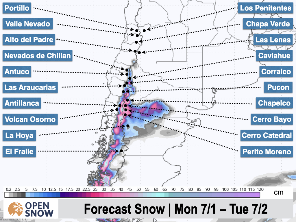
The first in this series of fast-moving storms is basically ending this (Monday) morning, but storm #2 will likely keep precipitation going without any break. This system will bring more snow from Monday to Tuesday afternoon. The latest snow forecast from the Canadian model for this system is shown below.
The third storm in this cycle will once again be right on the heels of the previous one, impacting the central and southern resorts from Tuesday evening through Thursday morning. An early look at snow totals from this round of snow is shown below.
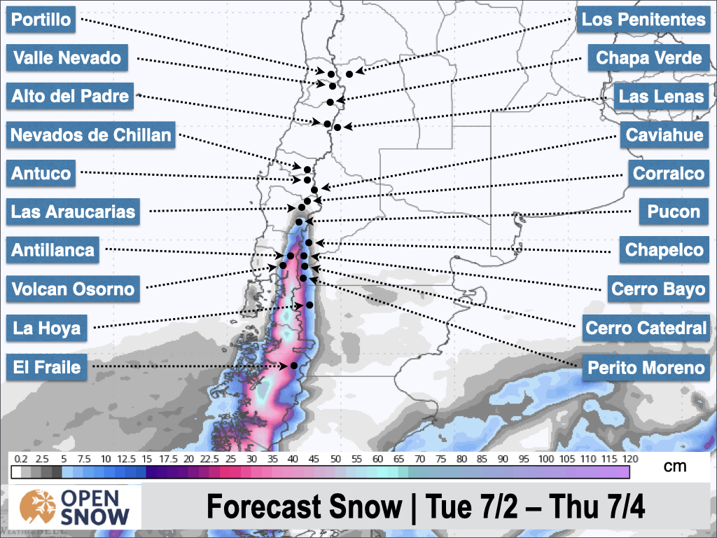
You can see the second storm especially is favoring the southern part of the central zone.
Extended Forecast
Later this week and into the following week we should see a break across all of the region as a ridge develops off the southern part of the continent. A weak storm is expected to sneak under the ridge over the weekend but it should stay far enough south to limit any impacts. Otherwise, the models aren't showing any signs of a significant storm in the long range at this time.
Next update on Wednesday.
Thanks for reading the South America Daily Snow!
Luke Stone
Forecaster, OpenSnow
Announcements

NEW: Global Weather Stations
Get the latest temperature, wind, and snow data from over 50,000 global weather stations with our new “Weather Stations” map overlay.
- Tap the “Maps” tab.
- Tap the overlay button.
- Tap “Weather Stations”.
- Select any chip at the top of the screen.
- Tap any station to view current and historical data.

Make sure you're updated to the latest version of the OpenSnow app (App Store / Google Play > OpenSnow > Update) or visit the OpenSnow website (OpenSnow.com).
View → Weather Station Map
About Our Forecaster


