South America Daily Snow

By Luke Stone, Forecaster Posted 1 year ago June 28, 2024
In Between Storms
Summary
Our latest storm that brought significant snow to the central zone moved east on Thursday. Most of the region saw some breaks of sun in the afternoon and will continue to see more calm conditions through most of the weekend. The first in a series of fast-moving storms arrives Saturday night, bringing snow and rain back to the central and southern zones through most of next week.
Short Term Forecast
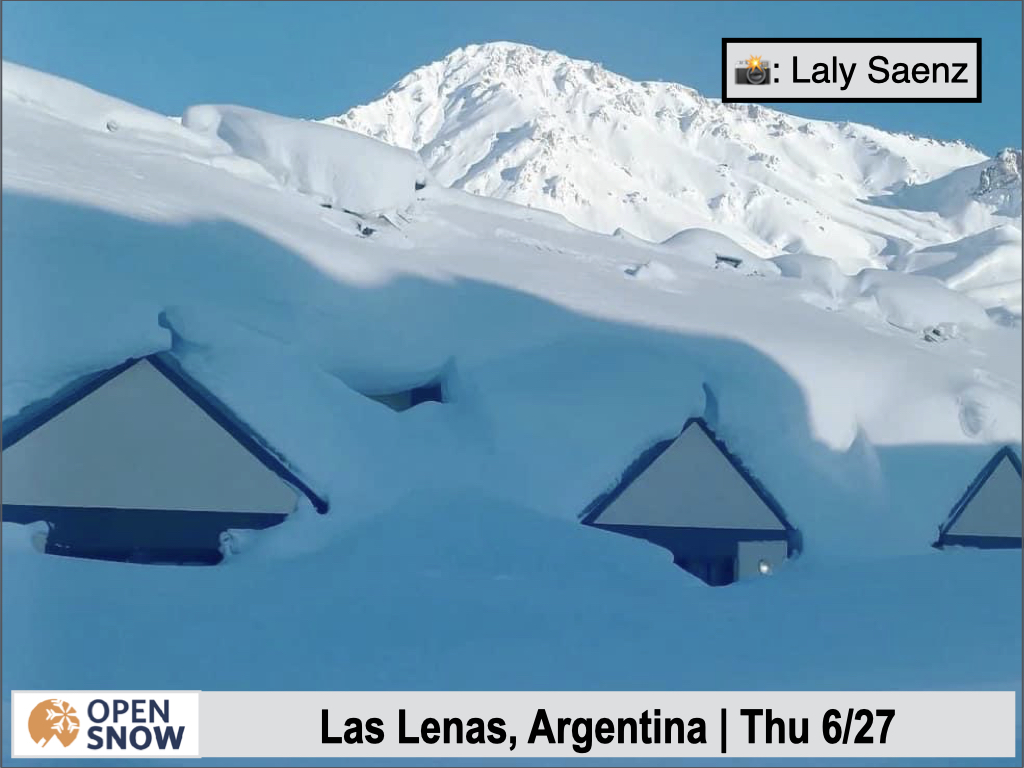
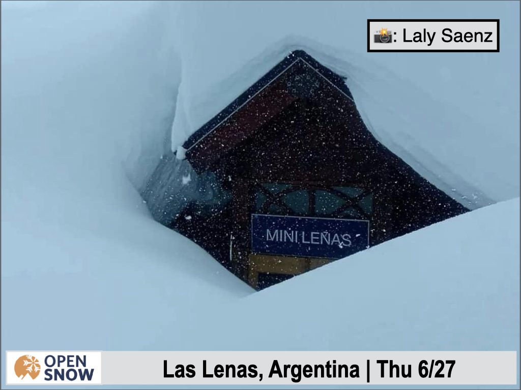
While Portillo and Las Lenas have been digging out in preparation for opening day, resorts in the central zone have received significant snow over the last few days. Below are a few more shots of the incredible snow in the northern zone, and some images of the recent accumulation in the central zone.


Recent avalanche control work at Portillo triggered a major slide, as you can see below.

The only snow totals I saw over the last few days were 30 cm on the upper mountain at Cerro Catedral and 40 cm on the upper mountain at Chapelco both from the previous twenty-four hours.
For the first time in weeks, the entire region should finally see a break in the action on Friday and Saturday, with a warming trend and some sunshine, especially in the northern zone. This won't last for long though, as another storm will soon cross the southern tip of the continent, bringing more rain and snow to the central and southern zones.
We can break this next series of storms into three phases.
- Phase 1: Saturday night - Sunday
- Phase 2: Monday morning - Tuesday
- Phase 3: Tuesday night - Friday
There will be little or no break between these storms, but three storms will be moving through the region during this period. The first of these will arrive late Saturday night, spreading snow from south to north overnight. Temperatures will rise initially, through Sunday morning, before starting to fall during the afternoon, but should stay at or just below resort bases. Snow showers will continue through Monday morning.
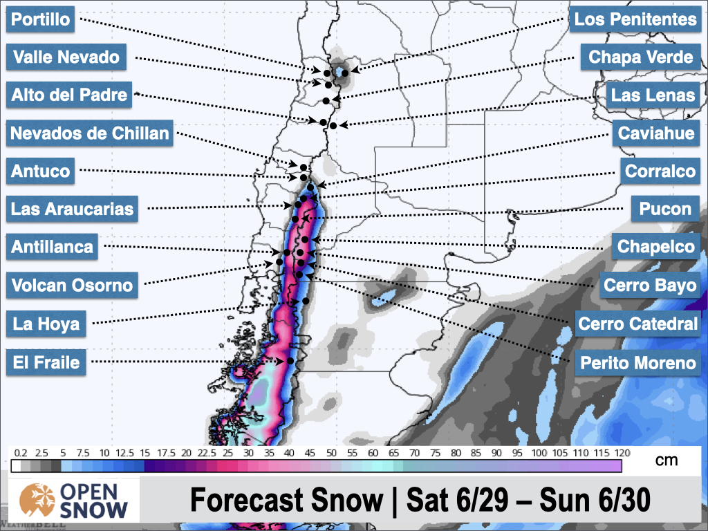
Expect 15 - 30 cm for the Chilean resorts in the central zone, with 5 - 15 cm farther south and east into Argentina. I think this storm will stay far enough south to result in any accumulation in the northern zone. The latest snow forecast from the American model is shown below.
As mentioned, the next storm in this series will be fast approaching, with a return to heavier precipitation on Monday. Snow levels will rise again on Monday and snow will continue to fall throughout the day. Another cold front is expected to move through Monday night and snow will persist through much of the day on Tuesday. Again without much of a break, the next storm will move in Tuesday night and little to no break in precipitation is expected. This storm will likely linger through much of next week. I'll have more details on these storms on Mon
Extended Forecast
The models show a ridge developing next weekend, continuing through the early part of the following week. This should produce a more prolonged period of dry weather if the long-range models hold. The next storm is possible around Tuesday the 9th.
Next update on Monday.
Thanks for reading the South America Daily Snow!
Luke Stone
Forecaster, OpenSnow
Announcements

NEW: Global Weather Stations
Get the latest temperature, wind, and snow data from over 50,000 global weather stations with our new “Weather Stations” map overlay.
- Tap the “Maps” tab.
- Tap the overlay button.
- Tap “Weather Stations”.
- Select any chip at the top of the screen.
- Tap any station to view current and historical data.

Make sure you're updated to the latest version of the OpenSnow app (App Store / Google Play > OpenSnow > Update) or visit the OpenSnow website (OpenSnow.com).
View → Weather Station Map
About Our Forecaster


