South America Daily Snow

By Luke Stone, Forecaster Posted 1 year ago June 26, 2024
A Break In the North, Central Stays Active
Summary
The extended period of heavy snow in the north has finally come to an end, leaving this region with an impressive June snowpack. The pattern remains active over the next week but with a more southerly storm track favoring the resorts in the central zone. Snow levels will climb a bit during this period, but significant snow is still expected as two strong storms move through the area.
Short Term Forecast
It's not often that a resort has to push back its opening day as a result of too MUCH snow. That is the case this season, though, as Las Lenas and Portillo have pushed back their opening days to June 29th for this reason. The updated snow total to date at Portillo is 567 cm (18.6 ft), which, according to the resort, exceeds the average annual snowfall by nearly 60 cm (2 ft).
Perhaps, fortunately, the storm track will shift farther south for the next week to ten days, sparing the mountains in the north from the heaviest snow. The next two storms will be fueled by atmospheric rivers and bring major moisture to the central zone. Although this forecast extends through the middle of next week and thus confidence isn't exceptionally high, the resorts in the central zone could see an additional 150 - 300 mm of precipitation.
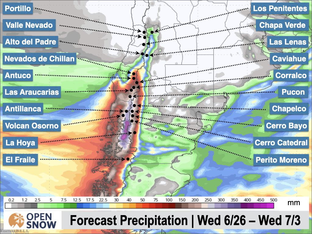
We're looking at major snow totals from both of the next two storms, which will impact the central zone from Wednesday through Friday of this week, and Sunday through Wednesday-ish of next week.
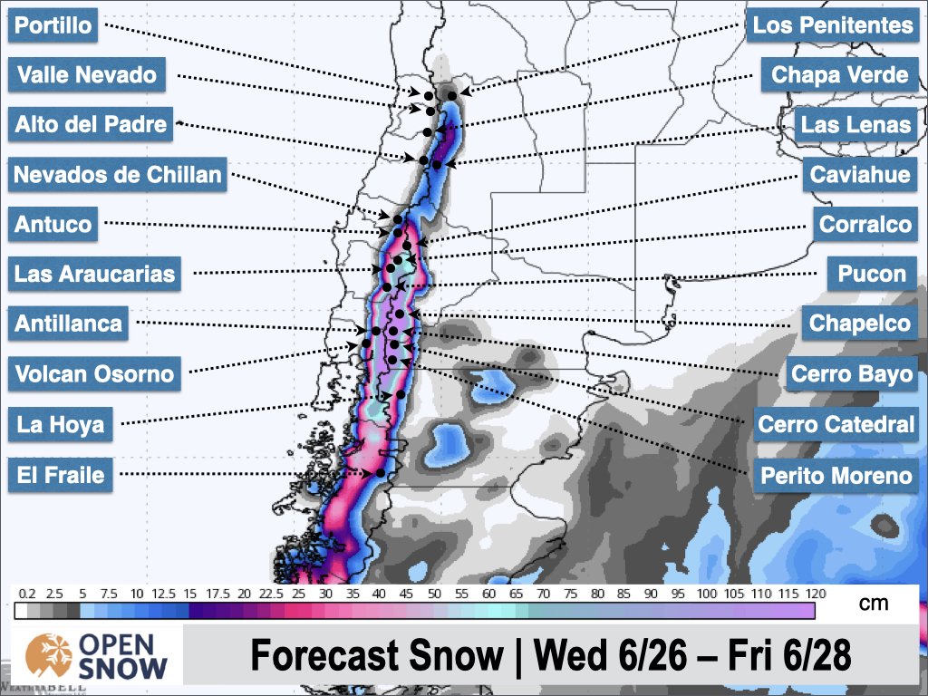
The latest storm is already underway this (Wednesday) morning, with snow levels rising throughout the day. They will climb close to or above most base elevations during this time but will start to fall Wednesday evening as a cold front approaches. By Thursday morning it should be snowing down to the bases of all the resorts.
Winds will be quite strong during this storm, with widespread gusts over 80 km/h and over 100 km/h in some spots. We may see some impacts to lift operations on Wednesday and Thursday before the winds subside Thursday night.
The heaviest snow is expected around Antillanca, Pucon, Volcan Osorno, Las Araucarias, and Corralco, where 40 - 80 cm is possible at mid-mountain and above through Friday. Farther south and east, totals should wind up in the 25 - 50 cm range, at resorts like Cerro Bayo, Cerro Catedral, and Chapelco. In the northern zone, expect 5 - 15 cm from this storm. The latest snow forecast from the American model is shown below.
After this storm winds down on Friday, we'll have a brief break between storms. Friday afternoon through Sunday afternoon should be mostly dry across all the resorts, providing some nice conditions for opening day at Portillo and Las Lenas.
The next system is slated to arrive late Saturday night and continue through the middle of next week. Snow levels are expected to climb as this storm gets going, likely above base elevations once again. The arrival of a cold front around Monday morning will quickly bring them back down and turn any rain over to snow. This storm looks even stronger than the previous one, with snow totals over 1 m possible in the central zone and strong winds. I'll have more details about this event on Friday.
Extended Forecast
We may finally see a more extended break from the end of next week through the middle of the following week. The northern zone will likely stay dry from this weekend through the middle of the following week. The storm track is forecast to shift even farther south during this time, but if that trends more north, the break in the action may not be quite as long.
Next update on Friday.
Thanks for reading the South America Daily Snow!
Luke Stone
Forecaster, OpenSnow
Announcements

NEW: Global Weather Stations
Get the latest temperature, wind, and snow data from over 50,000 global weather stations with our new “Weather Stations” map overlay.
- Tap the “Maps” tab.
- Tap the overlay button.
- Tap “Weather Stations”.
- Select any chip at the top of the screen.
- Tap any station to view current and historical data.

Make sure you're updated to the latest version of the OpenSnow app (App Store / Google Play > OpenSnow > Update) or visit the OpenSnow website (OpenSnow.com).
View → Weather Station Map
About Our Forecaster


