New Zealand Daily Snow

By Mike O'Connor, Meteorologist Posted 11 months ago August 9, 2024
Deep Totals for Canterbury, Strong Winds & a Little More Snow from Sunday
Summary
Thursday's snowstorm has delivered another deep load of powder to Canterbury ski fields, while the Southern Lakes and Mt Ruapehu received several centimetres. A little more snow will fall in northern Canterbury and on Mt Ruapehu before skies clear up Saturday. Winds will then whip over the country the following few days as as a front brings a dusting or small top-up to most ski fields.
Short Term Forecast
Snowstorm Tallies
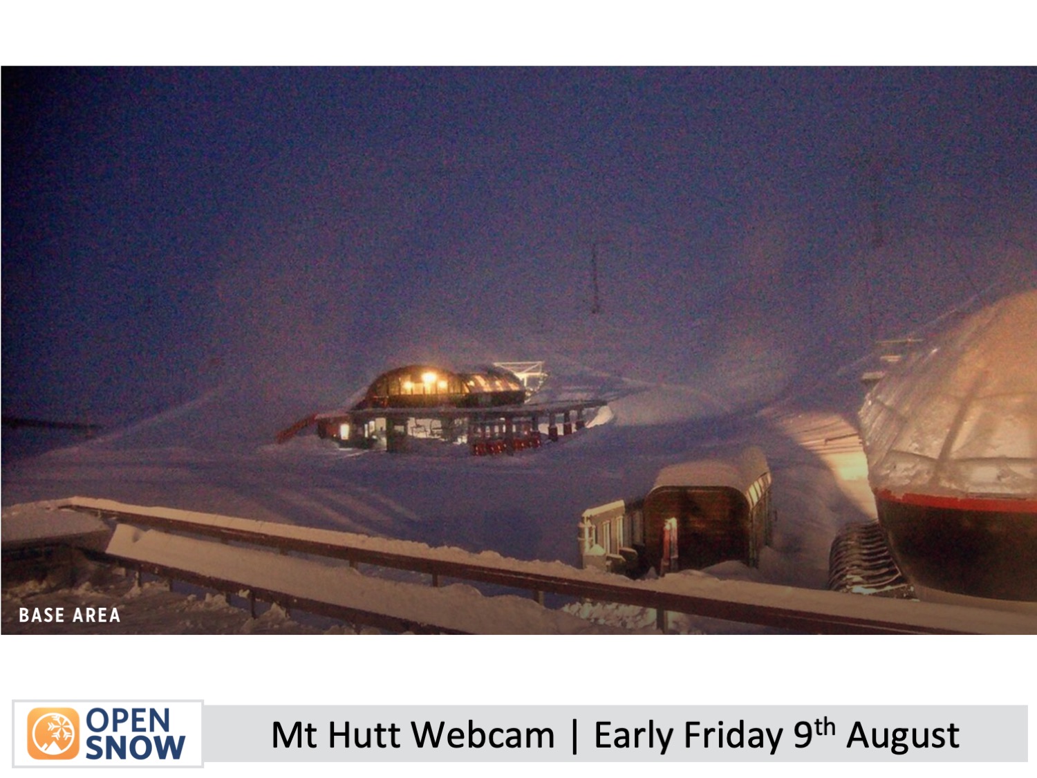
A snowstorm that hit the country yesterday has delivered deep powder yet again to Canterbury. Most reports have come in this Friday morning, and Mt Hutt leads with 43cm of fresh powder. The Craigieburn club fields scored between 10 and 37+ cm, while in the Mackenzie Basin, Ohau got 30cm and Roundhill 10cm. Mt Lyford in the north has had 8cm, and it's still snowing there, with another 10-15cm expected throughout the day. The Southern Lakes and Mt Ruapehu also received a light snowfall of 3-8cm and 3-7cm, respectively.
Friday & Saturday (9th & 10th August)
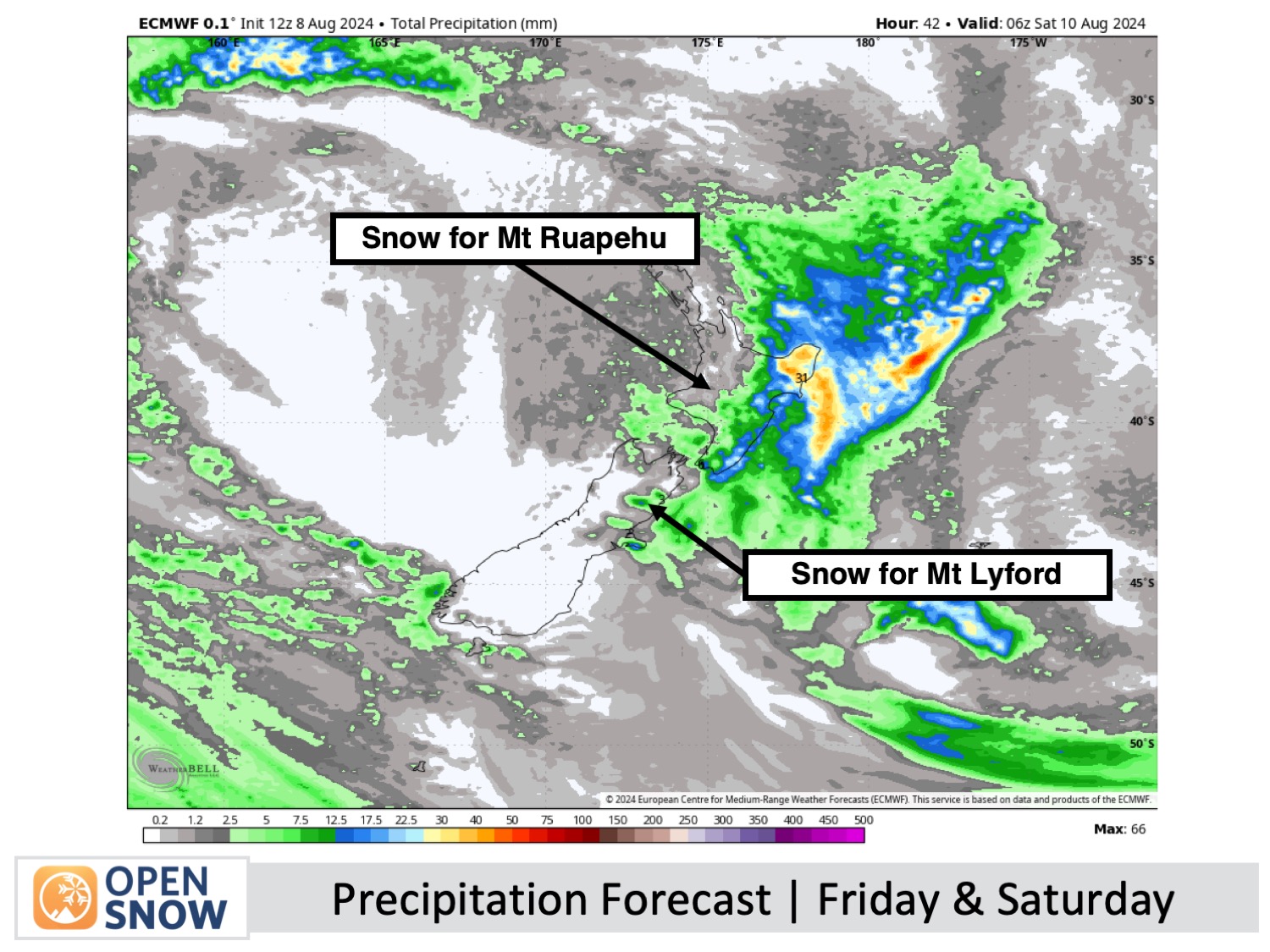
Friday is a deep powder day for Canterbury, but the crews will have a big clean-up job. Some ski fields will be delayed in opening and may not open until Saturday. Southerly winds on Friday will keep things cloudy and clagged in for central parts where snow has mostly finished falling, while snow will continue to fall in the north on Mt Lyford where another 10-15cm is expected. Come Saturday, the winds will have dropped right off for a clear and sunny day - it'll be a busy one as everyone will be champing to score some powder, so I'd say hit the small club fields to avoid the crowds.
Conditions will be great further south for the Southern Lakes and the Mackenzie Basin, with fine weather and light winds, although there will be some high clouds on Saturday.
Up on the North Island, southerly winds will bring light snow showers to Mt Ruapehu during the latter half of Friday into Saturday morning, with up to 5-10cm expected. Skies will start to clear up Saturday afternoon as winds ease.
Sunday to Tuesday (11th to 13th August)
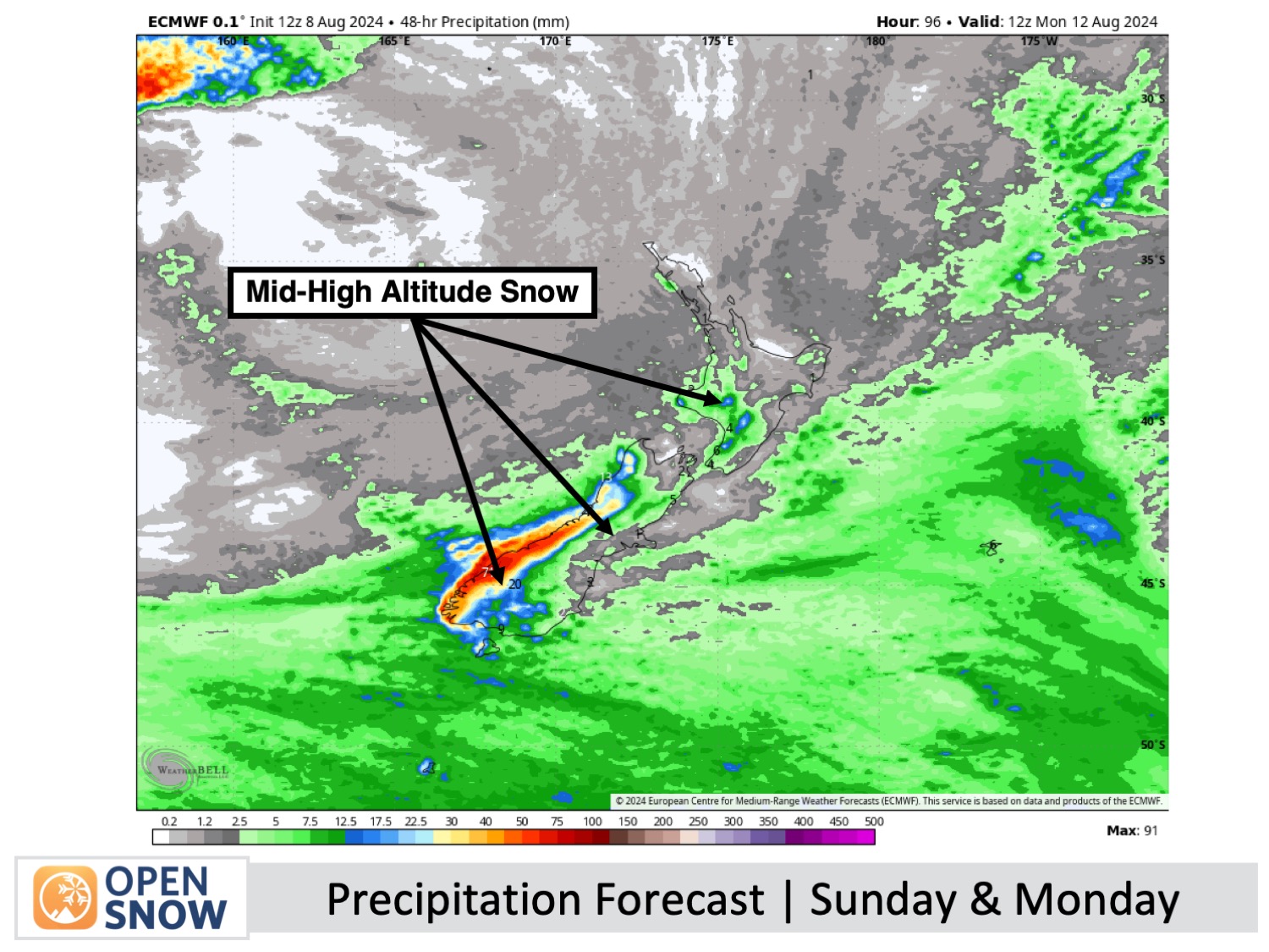
Strong winds will whip over the country during this period, starting out from the northwest on Sunday and rising to 80-100km/h in exposed areas. They will then turn southwest on Monday as a front passes through before easing a little on Tuesday. This will likely impact lift operations, especially on Sunday in Canterbury and on Monday in Mt Ruapehu.
Weatherwise, the Southern Lakes will pick up a little snow at mid-high elevations during Sunday's predawn hours, then a more decent top-up of around 5-15cm to base levels as the front passes through late Sunday afternoon into early Monday.
In Canterbury, high clouds will build on Sunday before a little rain and high-level snowfall Sunday night. As the front passes through on Monday, snow showers will favour Mt Lyford, with a couple of centimetres expected in the afternoon. A light dusting is expected at Mt Hutt and Porter's Pass, while all the other ski fields will miss out.
Mt Ruapehu will be partly cloudy on Sunday. On Monday, it'll snow at mid-high elevations with 5-15cm expected, but it'll fall as rain on the lower slopes.
Skies will be clear over all Kiwi ski fields on Tuesday.
Extended Forecast
Another weather system is expected to hit the country in the latter part of next week, bringing some potentially wild conditions. It’s still too early for specifics since the models are inconsistent, but it looks like most resorts will see some snow. I'll have more details in Monday's forecast.
Thanks for reading. I'll continue to provide these forecasts every Monday, Wednesday, and Friday throughout the southern hemisphere season.
Mike O'Connor
About Our Forecaster


