New Zealand Daily Snow

By Mike O'Connor, Meteorologist Posted 11 months ago August 11, 2024
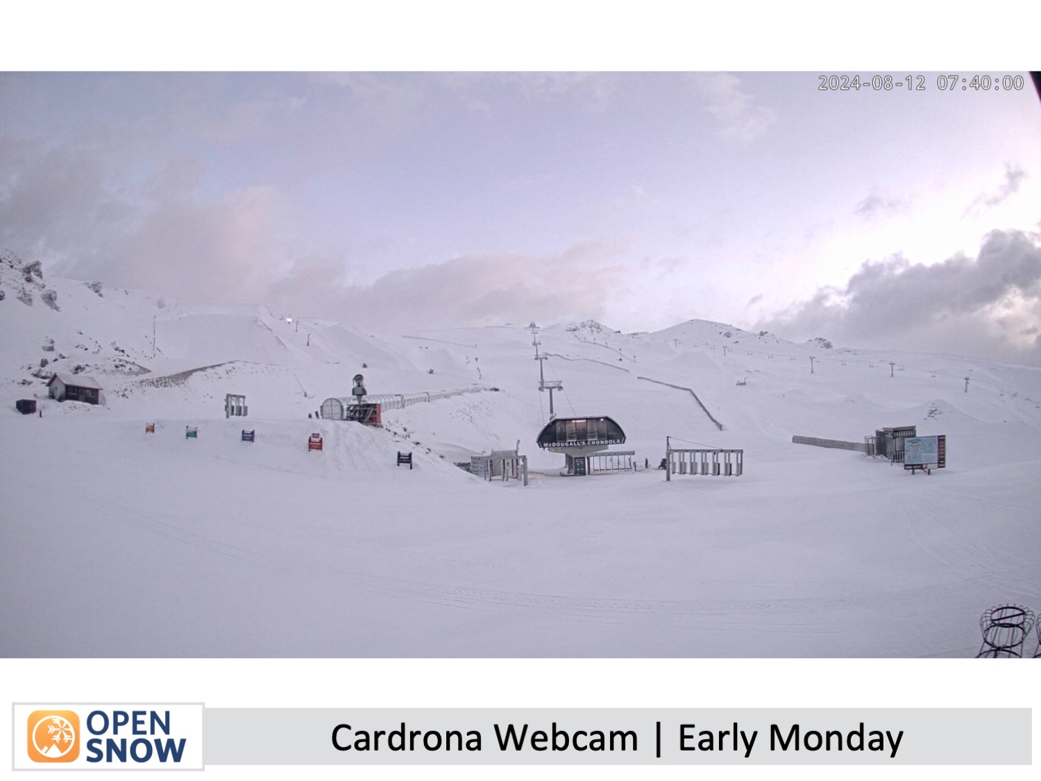
Some Snow & Strong Winds on the Menu
Summary
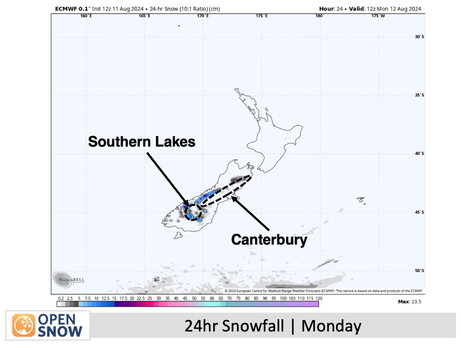
A front today will bring 2-7cm of snow to the Southern Lakes, a few cms to some Canterbury resorts, and snow up high to Mt Ruapehu, while strong winds disrupt lift operations. Sunny skies will follow for a couple of days as pressure builds, though winds will remain strong on Tuesday before easing Wednesday. Winds will strengthen again Thursday as a second front brings more snow up high.
Short Term Forecast
Monday to Wednesday (12th to 14th August)
On Monday, strong westerly winds over the country will disrupt lift operations at some resorts. As a front moves across the country, winds will shift to the southwest but remain strong. The Southern Lakes will see morning snow, though Treble Cone will get less, followed by sunshine in the afternoon. In Canterbury, morning rain and high-level snow, particularly around MacKenzie and Craigieburn, will clear to fine weather, but the front will bring afternoon snowfall to Mt Hutt, Porter's Pass, and Mt Lyford. On Mt Ruapehu, rain and mid- to high-level snow will start in the morning, intensify through the afternoon, and clear by night.
South Island resorts will enjoy clear, sunny weather on Tuesday, though SW winds will remain strong in exposed areas. On Ruapehu, strong southerlies will be at gale-force at higher elevations, with morning clouds and drizzle on the southern slopes clearing for a sunny afternoon.
Skies will remain sunny on Wednesday while winds gradually ease, although westerly winds will continue to blow over the Southern Lakes.
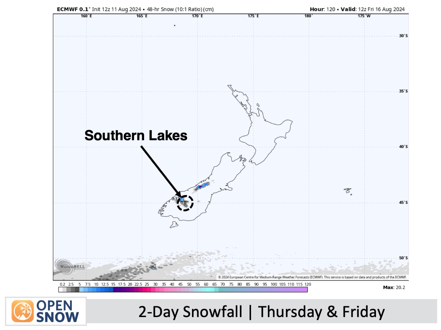
Thursday & Friday (15th & 16th August)
During this period, a front moves up the South Island on Thursday and will stall over the upper parts on Friday. West to northwest winds will be strong, especially on Thursday, when they'll likely reach severe gale in exposed locations by morning as skies become overcast.
Rain and high-altitude snow will spill over the South Island's Main Divide, mainly impacting Southern Lakes resorts on Thursday, with heavy falls in the afternoon as the front passes over the area. The front will move over Canterbury Thursday evening and night with a period of rain at most ski fields. The rain will be a little heavier on those closest to the Main Divide with some snow likely about the tops.
Friday for the South Island will bring partly cloudy skies as strong westerlies continue to blow. Light rain showers will continue to show up in Canterbury from time to time.
Meanwhile, up on Mt Ruapehu, westerly winds will also be fairly strong and will blow in clouds from Thursday afternoon onwards, then light showers of rain and high-altitude snow on Friday
Extended Forecast
Cold southerlies could bring more snow to the South Island this weekend as a low-pressure system moves closer from the Tasman Sea. The exact amount of snow remains uncertain at this point. Early next week, the low might bring rain, depending on its path over either the North Island or the South Island.
Thanks for reading. I'll continue to provide these forecasts every Monday, Wednesday, and Friday throughout the southern hemisphere season.
Mike O'Connor
About Our Forecaster


