South America Daily Snow

By Luke Stone, Forecaster Posted 1 year ago October 20, 2023
All Quiet on the South American Front, Until the 29th?
Summary
There won't be more than some passing showers during the next ten days, with warm and dry conditions prevailing. The long range models are picking up on a strong and cold storm towards the end of the month, around the 29th. Could we get one last powder day?
Short Term Forecast
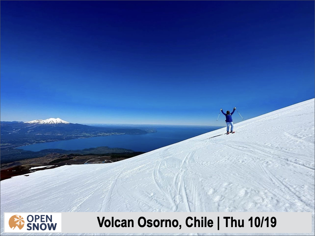
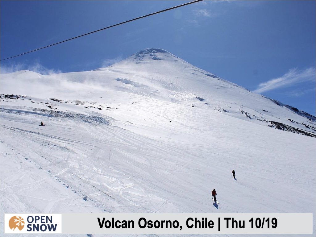
Volcan Osorno is going strong, open daily. Check out a few shots from them courtesy of their Instagram.
Since there's not a lot going on for the next ten days, let's take a quick look at the potential end of the month storm. The long range models, the ensembles, show strong agreement on a storm during this timeframe. You can see the storm around the 29th in the American, European, and Canadian ensemble mid level patterns below.
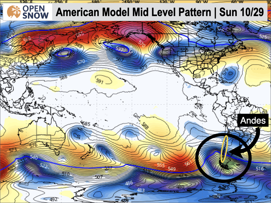
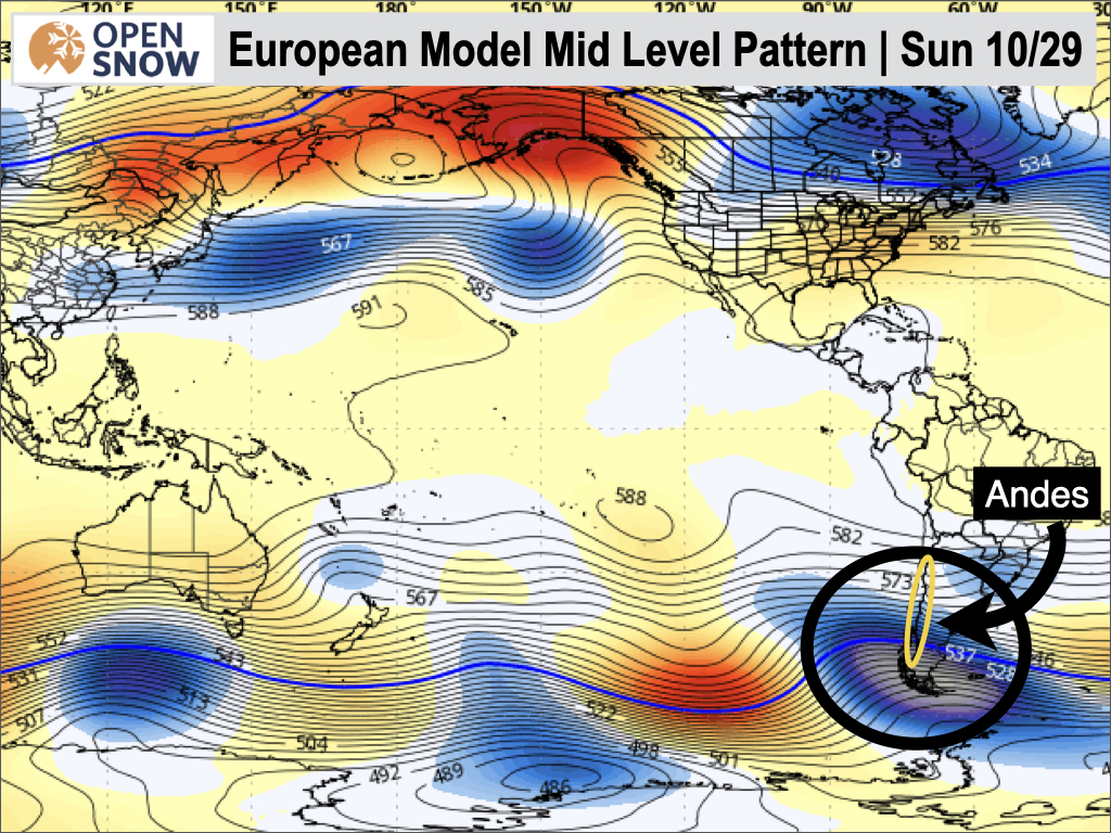
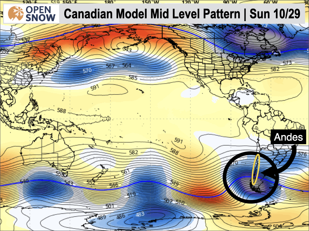
You can't ask for much more than this level agreement ten days out. If this storm track holds, Corralco and Volcan Osorno could be in store for a powdery closing weekend. I will keep an eye on this timeframe and have an update on Monday.
I will be posting a season recap soon, and would love to share any photos you got throughout the year. Email them to me at [email protected].
Thanks for reading the South America daily snow! Follow me @lstone84 on Instagram to track and chase storms all (North American) winter long!
About Our Forecaster


