New Zealand Daily Snow

Heads up, there may be fresher snow! Read the latest New Zealand Daily Snow

By Mike O'Connor, Meteorologist Posted 11 months ago July 28, 2024

Deep Powder as Antarctic Airmass Hits NZ

Summary

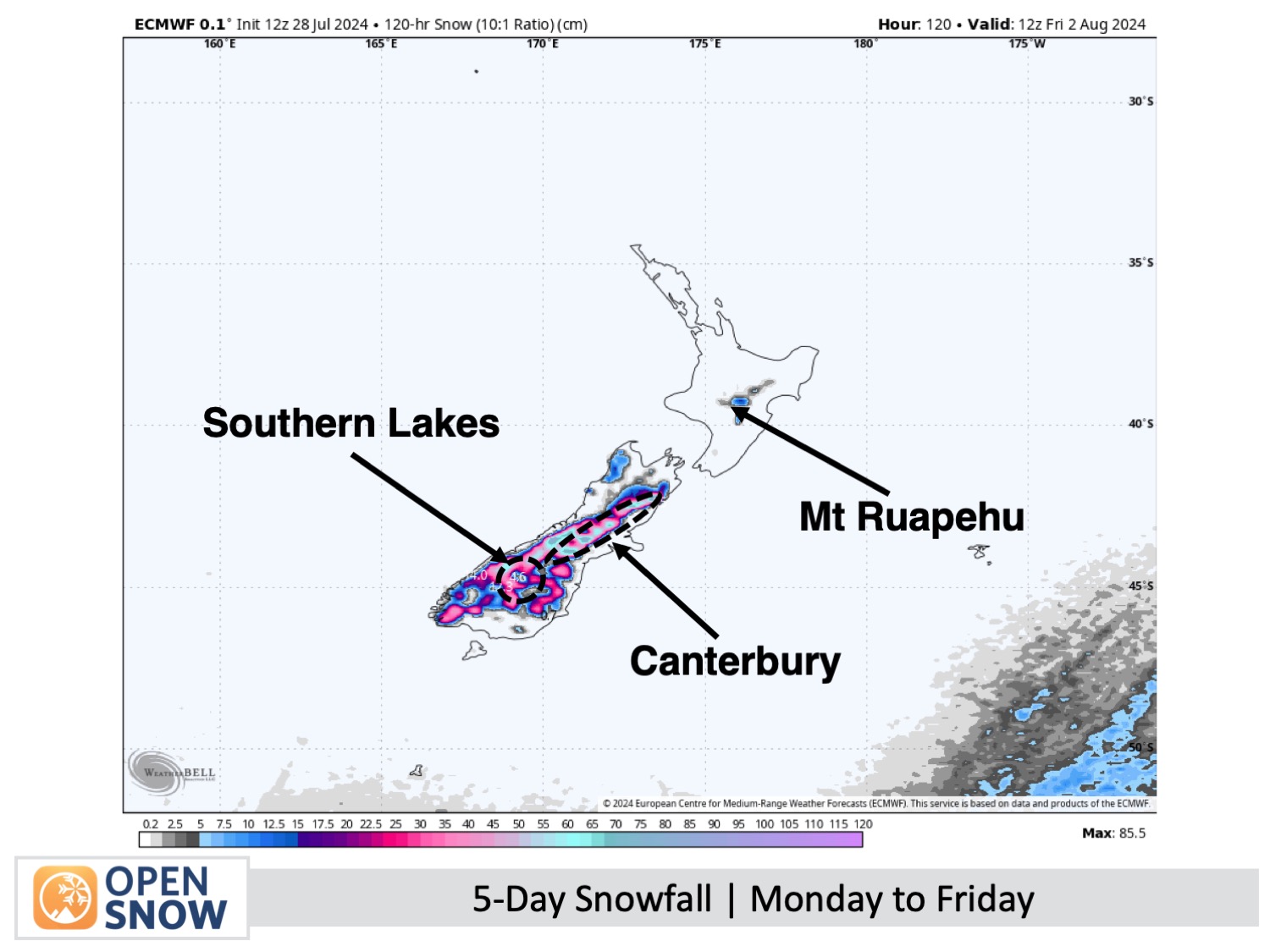
The eagerly awaited winter storm is almost here, promising significant snowfall. A polar air mass from Antarctica will move up the South Island, converting resort rain into snow across the 1Southern Lakes by early Monday and Canterbury by early Tuesday. This will lead to heavy snow down to elevations of 300-500m, disrupting roads but enabling some local fun!

Short Term Forecast

Forecast for Monday to Friday (29th July to 2nd August)

On Monday, it's a powder day in the Southern Lakes! Expect snow to start falling on the mid to upper slopes, dropping to around 900-1100m early in the morning and descending further at night, possibly impacting the top of the Crown Range Road. There will be periods of heavy snowfall with low visibility, and light easterly winds shifting to the southeast. In Canterbury, there'll be significant rain, but it will turn to snow at higher elevations in the morning. The weather might clear up a bit in the afternoon Monday, as the strong northwest winds die down.  

On Tuesday, more snow is expected across South Island resorts, with snow levels potentially dropping to 500m or lower, affecting some roads and towns. Snow showers will lighten in the Southern Lakes in the morning but intensify in Canterbury. Strong south-southeast winds will make it feel extremely cold, so dressing warmly is crucial, due to the severe wind chill.

As the day progresses in the Southern Lakes on Wednesday, any remaining light snow showers will clear up, leading to a brighter day as cloud cover starts to break. Despite this, the easterly winds will be bitterly cold. Heavy snowfall in Canterbury will lighten during the morning, with lighter snow continuing down to about 300-400m, impacting roads and towns. The area will remain cloudy with a few more light snow showers as the freezing south-southeast winds continue.

On Thursday in the Southern Lakes, the chilly easterly winds will continue, yet the skies above the resorts will remain clear and sharp, positioned over a layer of low clouds. In contrast, Canterbury will experience ongoing cloudy conditions with occasional light snow showers, as the cold south-southeast winds keep up.

Extended Forecast

The weather at South Island resorts is expected to stay mostly clear and chilly until the end of the week as a storm moves away from the North Island and a high-pressure system moves in from the south. The snow conditions will be fantastic, so it’s a great time to make plans, as the weather may get choppy again early next week.

Thanks for reading. I'll continue to provide these forecasts every Monday, Wednesday, and Friday throughout the southern hemisphere season.

Mike O'Connor

About Our Forecaster

Mike O'Connor

Meteorologist

Mike O'Connor is a Meteorologist based in New Zealand. Mike previously worked at the New Zealand MetService for 10 years and has been doing contract forecasting ever since.

Free OpenSnow App