New Zealand Daily Snow

By Mike O'Connor, Meteorologist Posted 1 year ago July 14, 2024
Only Light Disruptions to the Run of Fine Weather, Storm Arrives Weekend
Summary
The working week ahead will only bring mild disruptions to the incredible bluebird weather Kiwi ski fields have had over the past week. A couple of fronts crossing the country weaken when they reach the South Island, bringing mixed falls of light rain and snow—first on Monday night into early Tuesday, then again on Friday. The situation may then get wilder as a more intense storm arrives.
Short Term Forecast

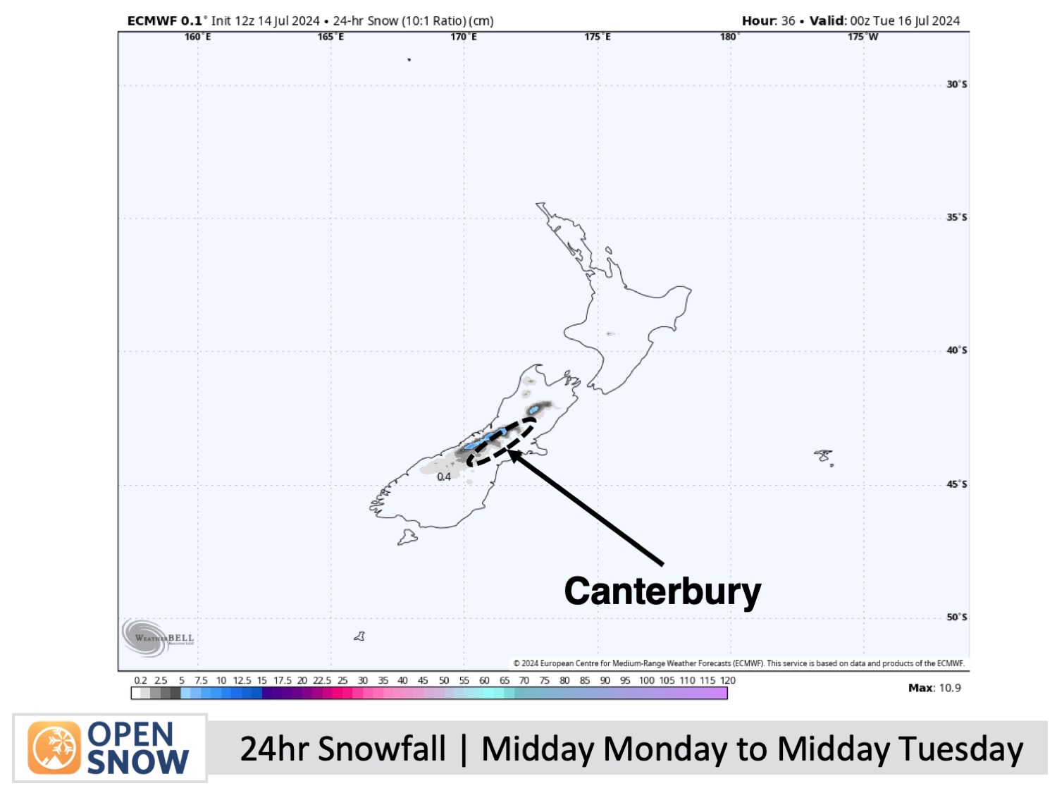
Forecast for Monday & Tuesday (15th & 16th July)
Monday will be fine and sunny for South Island ski fields, which sit nicely above a deck of low-level cloud hanging at the top of an inversion layer below.
A weakening front crosses the South Island Monday evening through early Tuesday morning, bringing a light dusting of up to 1-4cm to Canterbury fields. This will be followed by a little light rain as warmer air from the north arrives. The Southern Lakes will also see a few light snow showers, but less than 1cm will accumulate.
After the front's passage, the weather will clear out, returning to fine and calm conditions on Tuesday afternoon.
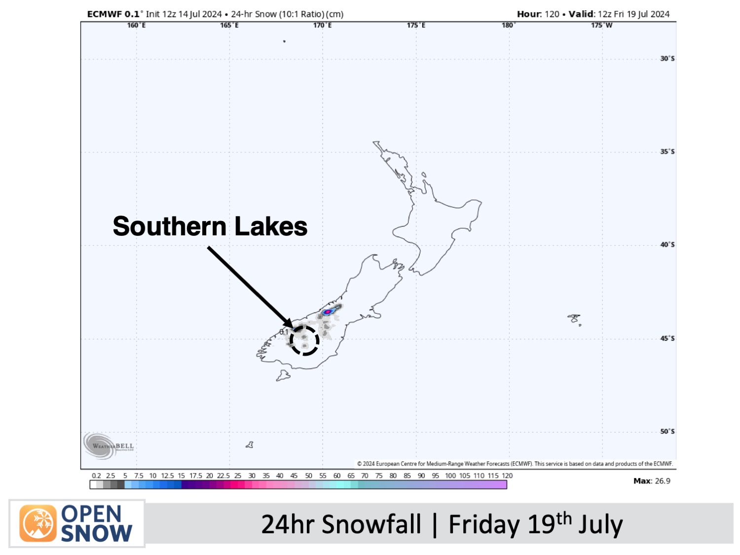
Forecast for Wednesday to Friday (17th to 19th July)
South Island ski fields will remain mostly fine with light winds throughout this period. However, on Wednesday, low-level cloud and some light drizzle will affect Canterbury, creating murky conditions and limiting the visibility on some ski fields, including Mt Hutt.
Also, on Friday, another weak front will likely see light showers of rain and high-level snow spilling over the Main Divide. At this stage, this is only expected to affect the Southern Lakes. However, this situation is liable to change as there's a lot of uncertainty due to a rapidly strengthening storm approaching the country from the north.
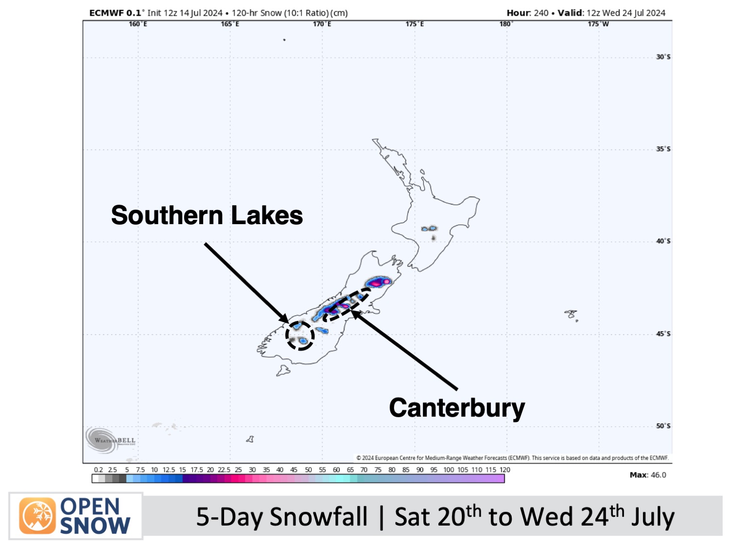
Extended Forecast
Things are likely to get wild during the extended period. Starting this weekend, July 20th and 21st, the rapidly strengthening storm mentioned above is expected to drop down from the north and park up just east of the country for a few days before moving off around the middle of next week (around the 24th of July).
This is expected to bring a period of heavy rain to the North Island, followed by mid- to high-level snow for Mt Ruapehu. Canterbury could also experience the same, but snow levels may reach base levels as mild easterly winds gradually turn to a cooler southerly, and here, we could potentially be left with a deep load of powder. The Southern Lakes, meanwhile, are expected to receive much lighter accumulations as the area will sit right at the edge of the storm's reach.
Thanks for reading. I'll continue to provide these forecasts every Monday, Wednesday, and Friday throughout the southern hemisphere season.
Mike O'Connor
About Our Forecaster


