South America Daily Snow

By Luke Stone, Forecaster Posted 1 year ago May 26, 2024
Snow Showers Sunday, Weak Storm Mid-Week
Summary
A weak storm will bring some additional snow showers on Sunday before wrapping up later in the afternoon. Another storm tracking to the south mid-week will bring some minor impacts to the central and southern zones. The rest of the week should stay mostly dry with no major storms in sight at this time.
Short Term Forecast
Last week's major storm brought some impressive snow totals to the region, especially in the northern zone. Portillo finished with 1.35 m, while El Colorado and Valle Nevado received 1.1 m at the base.

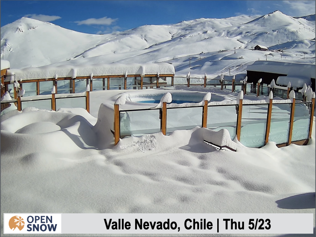

The recent snow is allowing several other resorts to open this month, including Chapa Verde, La Parva, and Valle Nevado. It's been quite a start to the season, with one of the snowiest Mays in the last decade.
We'll have some snow showers continue today, Sunday, and some minor snow in the central and southern zones mid-week, but there are no major storms in the forecast. We could see up to 10 cm by the end of the day, though most spots in the northern zone will see just a few cm.
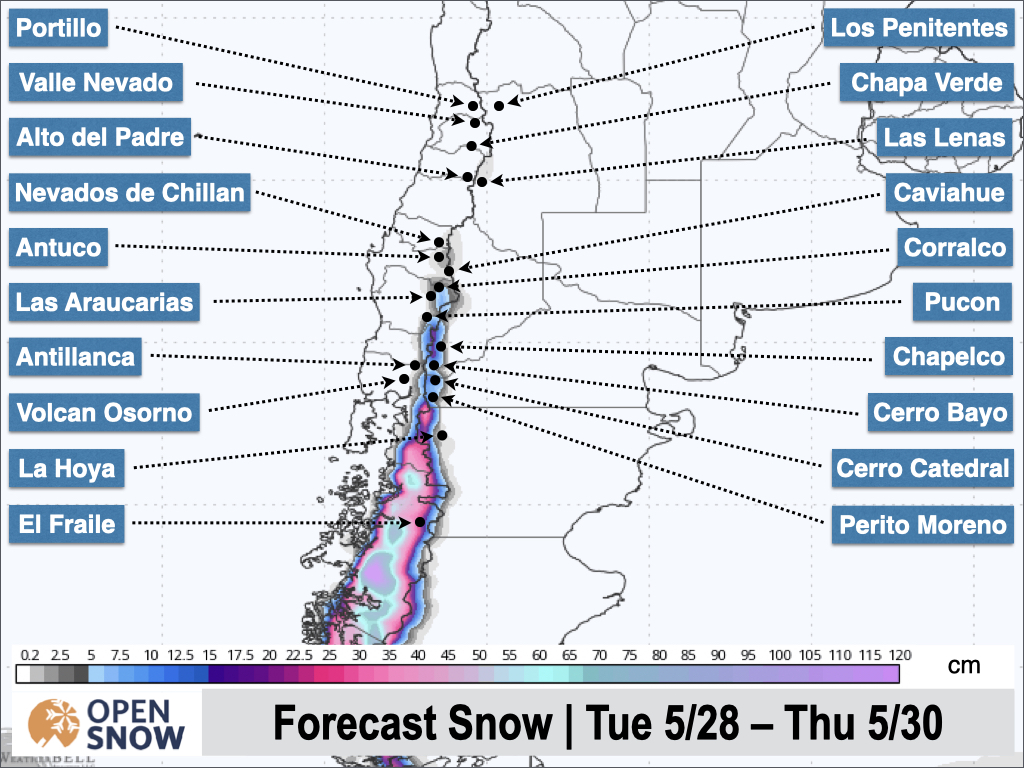
The midweek storm I mentioned a few forecasts back is tracking a bit farther north in the latest model runs. This will bring some light to moderate snow to the central and southern zones, with generally 5 - 15 cm. The latest snow forecast from the American model is shown below.
This storm should wind down Wednesday evening and the rest of the workweek will be dry.
Extended Forecast
Another round of snow showers is possible this weekend but accumulations look minor at this time. The models are starting to pick up on a somewhat stronger storm for the middle of next week, but it's too early to talk timing and totals. Hopefully, we'll see a trend for a stronger storm over the next few days.
Thanks for reading the South America Daily Snow!
Next update on Tuesday.
Luke Stone
Forecaster, OpenSnow
Announcements

About Our Forecaster


