Australia Daily Snow

By Mike O'Connor, Meteorologist Posted 10 months ago September 1, 2024
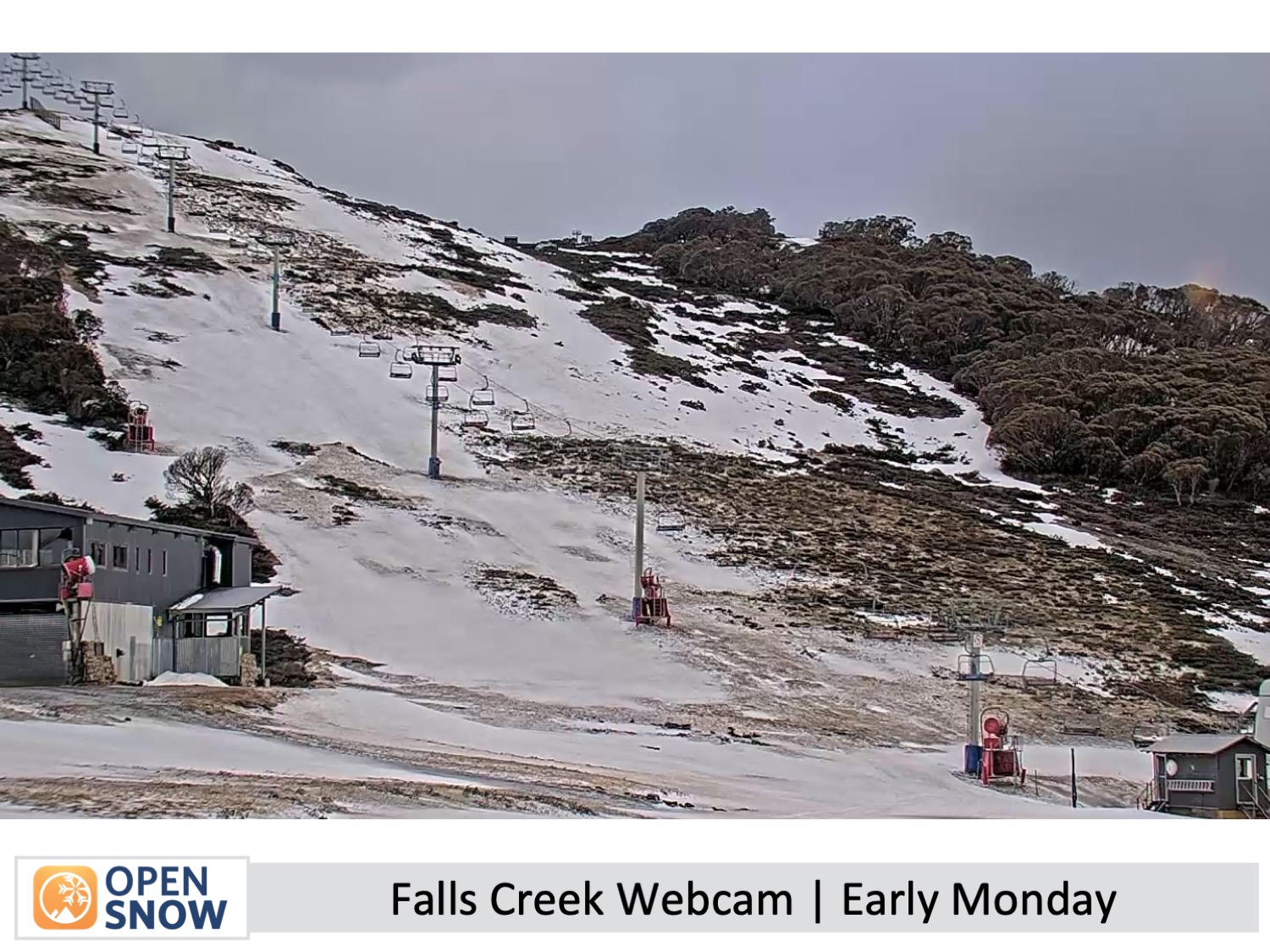
Resorts close, strong winds continue
Summary
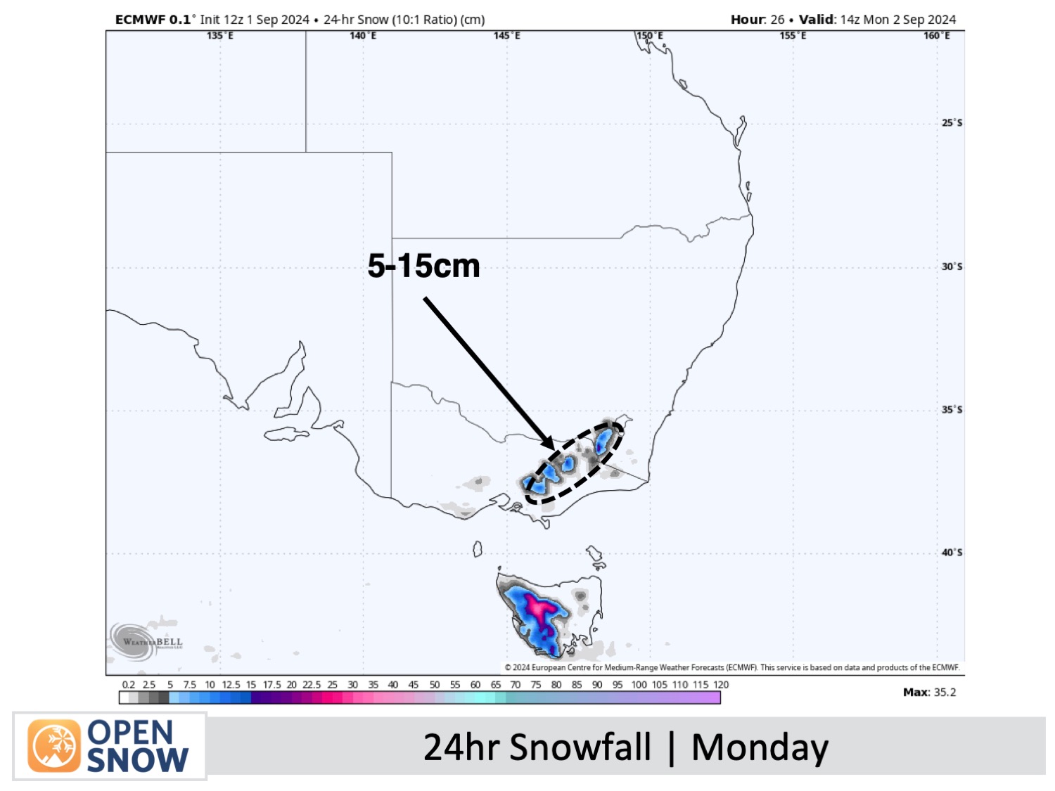
August brought harsh weather, shrinking the snowpack instead of allowing it to peak. Selwyn closed last weekend, with Mt Baw Baw and Buller on Sunday, and Mt Hotham will close Wednesday. A cold front today brings 5-15cm of snow, but strong winds may limit access. Tuesday offers a brief chance for better conditions before warm northwesterlies resume on Wednesday, continuing the melt.
Short Term Forecast
Monday & Tuesday (2nd & 3rd September)
Snow will push east early in the morning Monday, as a cold front moves through, continuing throughout the day and clearing by night, leaving 5-15cm of new snow below base levels. Gale-force northwesterly winds will shift to westerly, likely causing blizzard-like conditions and affecting lift operations.
Morning clouds will clear on Tuesday, giving way to a sunny day as strong southwesterly winds gradually subside.
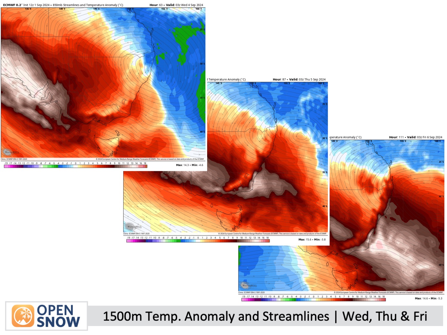
Wednesday to Friday 4th to 6th September)
Clear skies all day for Wednesday, but those warm, strong northwesterly winds will pick up and hit gale force by evening.
Strong northwesterly winds will continue to blow hard on Thursday. It’ll be mostly clear, but a few light showers might pop up in western Victoria. Expect those same winds on Friday, too. A weak front brings a little rain Friday night.
Extended Forecast
The weekend and early next week will see continued westerly winds, but not as intense. The weather will generally be fine, with a slight chance of some high-level snow on Sunday or Monday.
Thanks for reading. I'll continue to provide these forecasts every Monday, Wednesday, and Friday throughout the southern hemisphere season.
Mike O'Connor
About Our Forecaster


