Australia Daily Snow

By Mike O'Connor, Meteorologist Posted 1 year ago July 18, 2024
Snowstorm 2.0 will be a Game Changer
Summary
The biggest snowstorm of the season so far is expected to drop up to around half a metre of snow in the Australian Alps on Friday and Saturday. This comes on the heels of 10-30cm earlier in the week and will completely change the game here in Australia. Wet, humid conditions on Sunday and Monday will muck up the snow quality a little, but that'll clear up for Tuesday.
Short Term Forecast
Friday & Saturday (19th & 20th July)
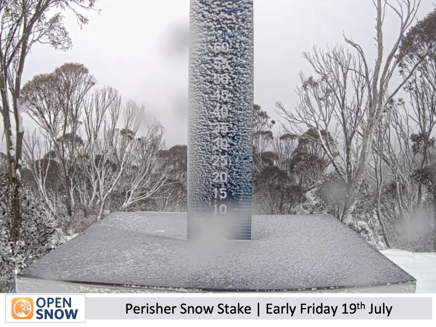
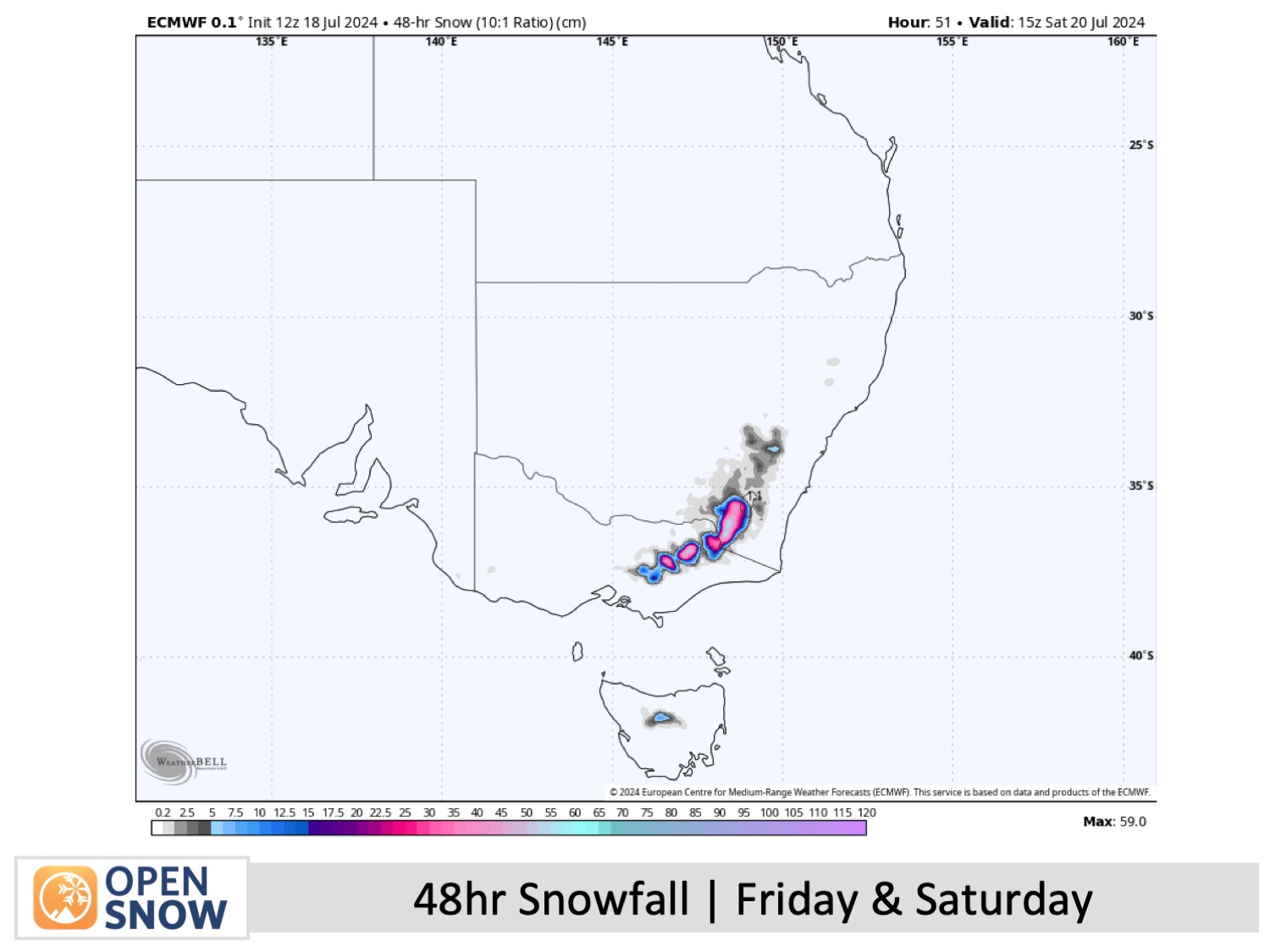
A strong snowstorm will nail the Australian Alps on Friday and Saturday. Amazingly, models have upgraded the storm, and we're now looking at accumulations of around 35-55cm above about 1500m, perhaps making this the biggest one of the season so far.
About half as much could be expected down lower due to milder temperatures there initially causing the snow to be denser, or simply just rain (especially for Mt Baw Baw). However, colder air arrives early Saturday, so snow levels will drop below resort base levels. Afterwards, resorts will likely get up to 100% operational and off-piste areas will open up.
The snowstorm will build during Friday as northwest winds rise to 100-120km/h, with light snowfall gradually becoming heavy Friday night. The storm will then wind down through the latter half of Saturday before snow clears Saturday night. Suffice to say that conditions will be wild, so lift operations are highly likely to be affected.
Sunday to Tuesday (21st to 23rd July)
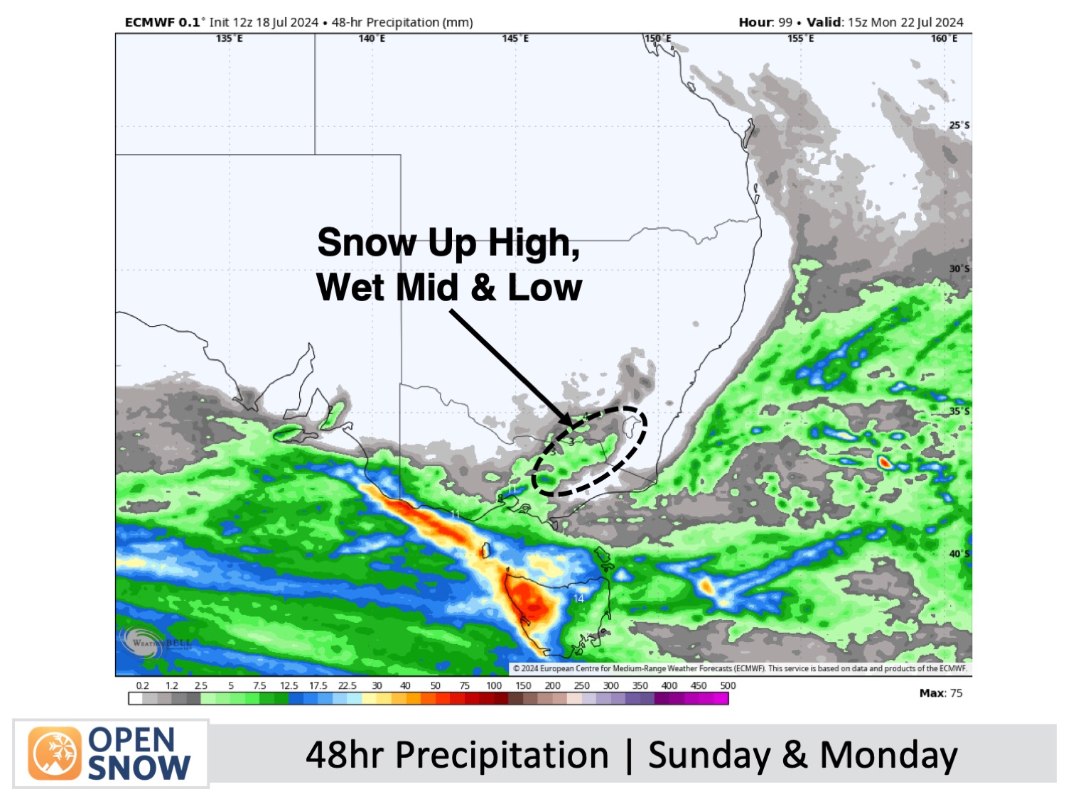
Strong and humid west-to-northwest winds will continue to blow during Sunday and Monday as another passing storm brushes the Australian Alps. Temperatures will be a little warmer, so snowfall will be restricted to high altitudes, while rain and drizzle create wet, mucky conditions down lower. That should all start to clear up late Monday, leaving just high clouds and mild northwest winds for Tuesday.
Extended Forecast
More stormy conditions are on the cards from about Thursday, July 25th. The exact details of this weather pattern are still uncertain, but we could see an initial period of rain and high-level snow before a cold change brings higher-quality snowfall to lower levels.
Thanks for reading. I'll continue to provide these forecasts every Monday, Wednesday, and Friday throughout the southern hemisphere season.
Mike O'Connor
About Our Forecaster


