Australia Daily Snow

By Mike O'Connor, Meteorologist Posted 1 year ago July 16, 2024
Another Snowstorm Late Friday & Saturday
Summary
The Australian Alps are much whiter after 10-35cm of snow fell on Monday and Tuesday. It did get a bit warm and wet on Tuesday, mind you, but things have improved immensely with a thicker snowpack and more terrain opening up. Things will get even better after another storm is set to dump up to 25-35cm late Friday and Saturday.
Short Term Forecast
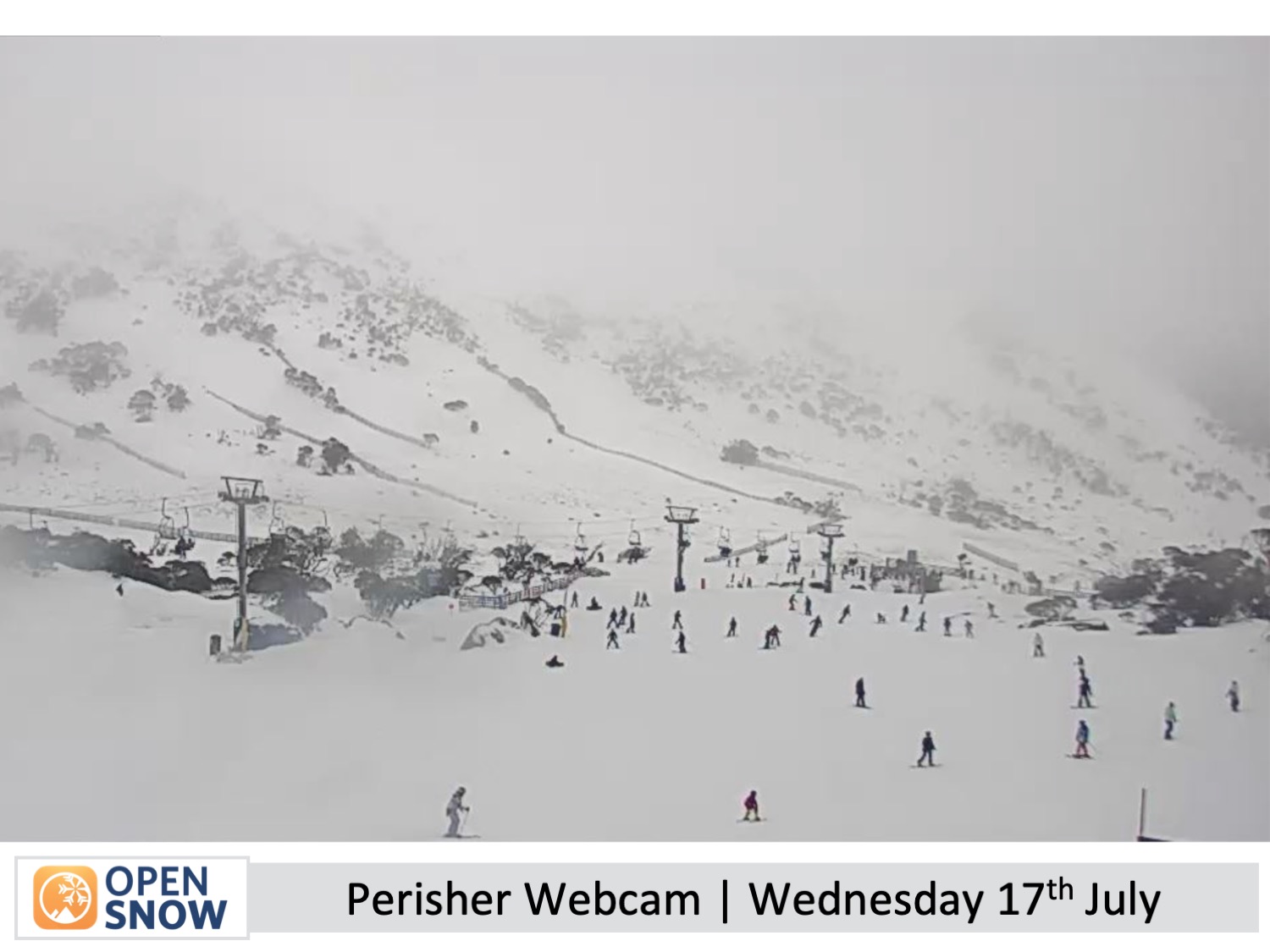
Wednesday & Thursday (17th & 18th July)
Southerly winds on Wednesday will bring a little light snowfall to terrain in New South Wales above about 1700m. Drizzly, misty conditions will affect lower altitudes of resorts there as well as Mt Baw Baw. However, it'll all start clearing and brightening up later in the day.
Cooler southwest winds on Thursday will favour Mt Baw Baw, with light snow showers to low levels there for most of the day, adding up to around 5cm. Only one or two will turn up at the other resorts at some point during the day, but the snow machines will get a chance to make up the shortfall.
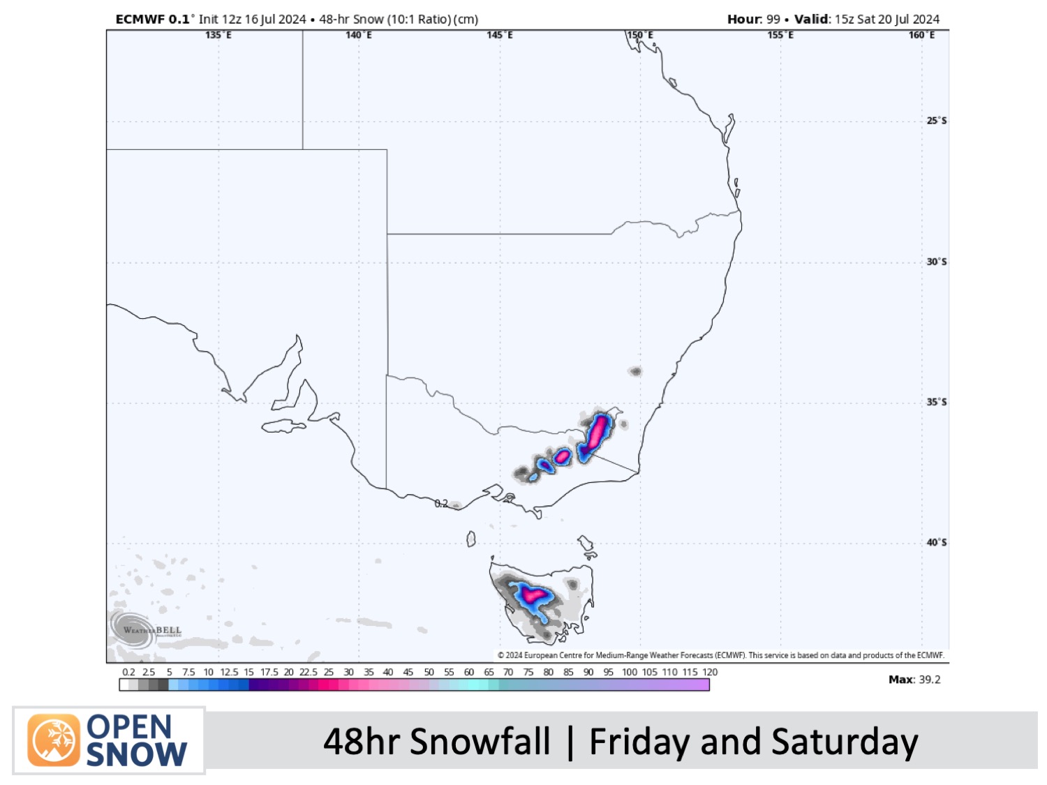
Friday & Saturday (19th & 20th July)
A storm from the west will spread snow over the Australian Alps during the second half of Friday, bringing heavy falls Friday night before gradually pinning back to light snow showers by the end of Saturday.
Around 25-35cm is expected on terrain above about 1500m. About half as much is likely lower down due to snowfall there being initially wet and dense before snow levels plummet to around 1000m early Saturday.
Conditions will be rough as guts, with freezing winds reaching 100-120km/h and poor visibility. Resorts will likely limit their operations as they hunker down for the storm. However, the payoff will be worth it, as they'll be in much better condition than before. After the clean-up, we should see even more terrain open up, including off-piste areas.
Extended Forecast
A weak storm should bring more snow across Sunday, July 21st, and Monday, July 22nd. However, snow levels will gradually creep up, turning it wet and dense at mid- and lower altitudes. Model forecasts are hinting at more storm activity and potential snowfall through the back half of that week.
Thanks for reading. I'll continue to provide these forecasts every Monday, Wednesday, and Friday throughout the southern hemisphere season.
Mike O'Connor
About Our Forecaster


