Winter Park Daily Snow

By Joel Gratz, Founding Meteorologist Posted 3 years ago April 10, 2022
Sunday Freshies
Summary
We'll enjoy some new snow on Sunday morning, and then will look ahead to a significant storm on Tuesday into Wednesday.
Update
On Saturday night, a strong and fast-moving storm dropped 4 inches of snow across the mountain.
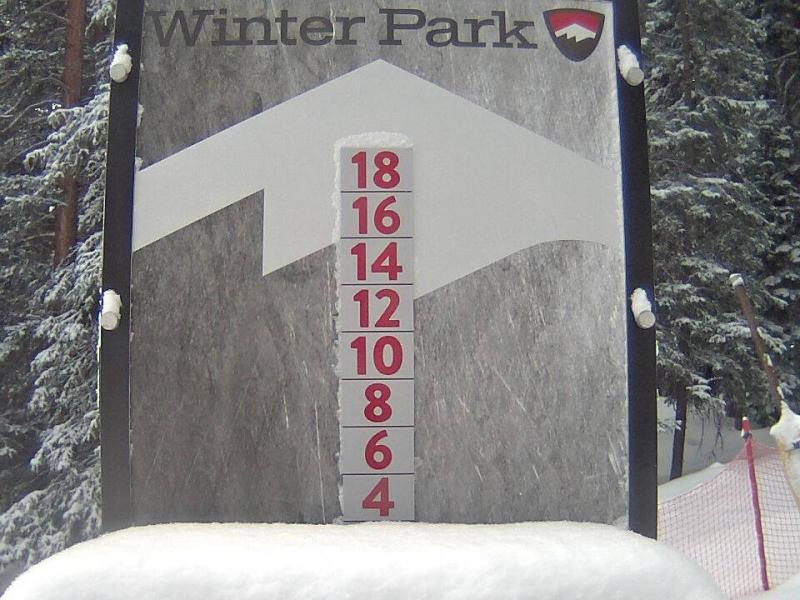
This new snow will likely be best enjoyed on top of groomed runs as it's not enough to truly soften the hard base on non-groomed runs. Enjoy this new snow on Sunday morning under partly sunny skies and a chilly feel to the air with temperatures in the teens and low 20s and gusty winds at times.
Monday will be dry with a high temperature in the 30s, and then a significant storm will bring snow from Tuesday morning through the day on Wednesday. We will have a good shot at getting more than 10 inches of snow during this time. Tuesday will be the beginning of the storm with conditions softening and deepening through the day with 4+ inches by the afternoon. Then Tuesday night through Wednesday night is more uncertain as we might only see a few more inches of fluffy snow, or we could see another 6+ inches of fluffy snow, which would make Wednesday deeper and pretty darn fun, with soft snow possibly on Thursday as well.
Following the snow on Tuesday into Wednesday, Thursday into Friday could be drier, and then we might see more snow sometime between later Friday, April 15, and Sunday, April 17.
Thanks for reading and please check back each morning for daily updates!
JOEL GRATZ
Meteorologist at OpenSnow.com
Snow conditions as of Sunday morning
New snow mid-mountain:
* 4” (24 hours Saturday 500am to Sunday 500am)
* 4” (Overnight Saturday 400pm to Sunday 500am)
Last snowfall:
* 4” Saturday Night (Apr 9-10)
Terrain
* 17 of 23 lifts
* 146 of 166 trails
* Latest update
Snowpack compared to the 30-year average:
* 81%
About Our Forecaster


