Australia Daily Snow

By Mike O'Connor, Meteorologist Posted 4 days ago July 27, 2025
More Powder Up High Before Storm Clears, Cold Rest of the Week
Summary
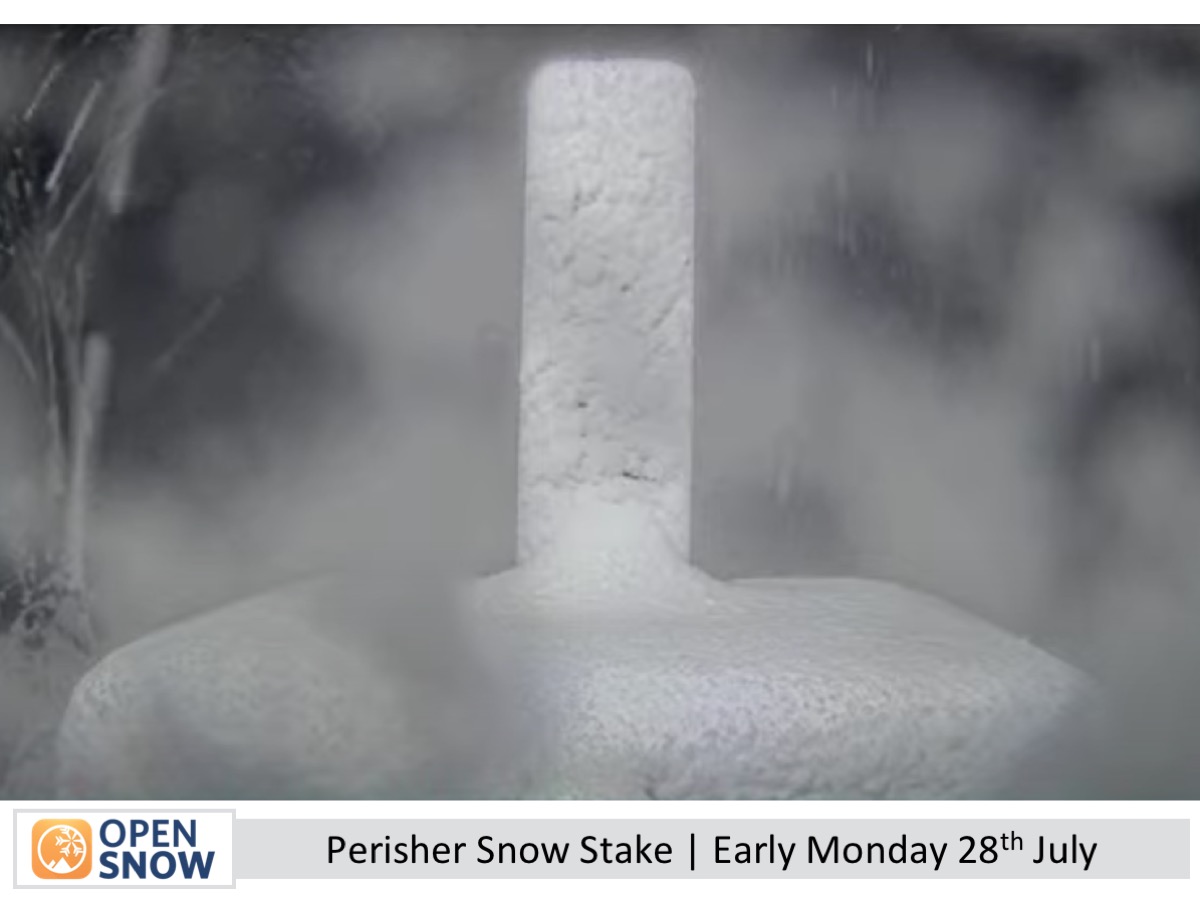
A storm brought 10–25+ cm of snow to upper Australian Alps slopes, while lower areas were wet. Cooler temps lowered snow levels, with Perisher showing 10–15 cm of powder. More snow is due before Tuesday, then a chilly southeast flow from midweek brings light NSW snow and good snowmaking conditions.
Short Term Forecast
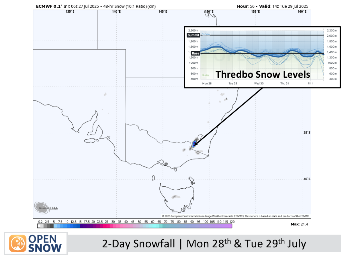
Forecast for Monday 28th & Tuesday 29th July
Snow falls on Monday, with rising snow levels and rain below 1600–1700 m easing in the evening. This is followed by a mostly cloudy Tuesday with light flurries and rain on Mt Baw Baw as winds gradually ease.
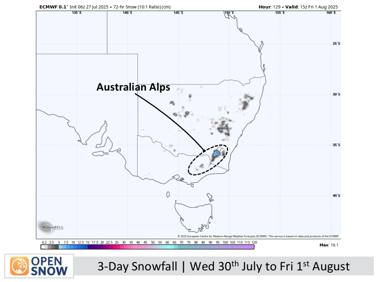
Forecast for Wednesday 30th July to Friday 1st August
Wednesday will bring chilly southeast winds, cloud, and light snowfall, with 2-6cm possible in New South Wales and just a dusting in Victoria, mostly fine at Mt Buller. Thursday and Friday will be partly cloudy with persistent chilly southeast winds and occasional snow flurries, especially around Mt Baw Baw.
Extended Forecast
Southeasterlies will linger through Saturday before easing Sunday, as the northern low moves toward the Tasman Sea. A fresh storm is forecast to deliver a mix of rain and snow between Tuesday and Wednesday, August 5th and 6th.
Thanks for reading. The next forecast will be out on Wednesday.
Mike
About Our Forecaster


