Australia Daily Snow

By Mike O'Connor, Meteorologist Posted 1 year ago July 2, 2024
Perfect Conditions for Fair-Weather Shredding
Summary
The sunny, dry spell continues until the end of the week thanks to happy high pressure dominating our charts. Snowpack conditions are great after around 20m fell at the weekend. Cold temperatures have kept it in good nick while the snowmakers have, and will, continue to improve things even more.
Short Term Forecast
Current Conditions
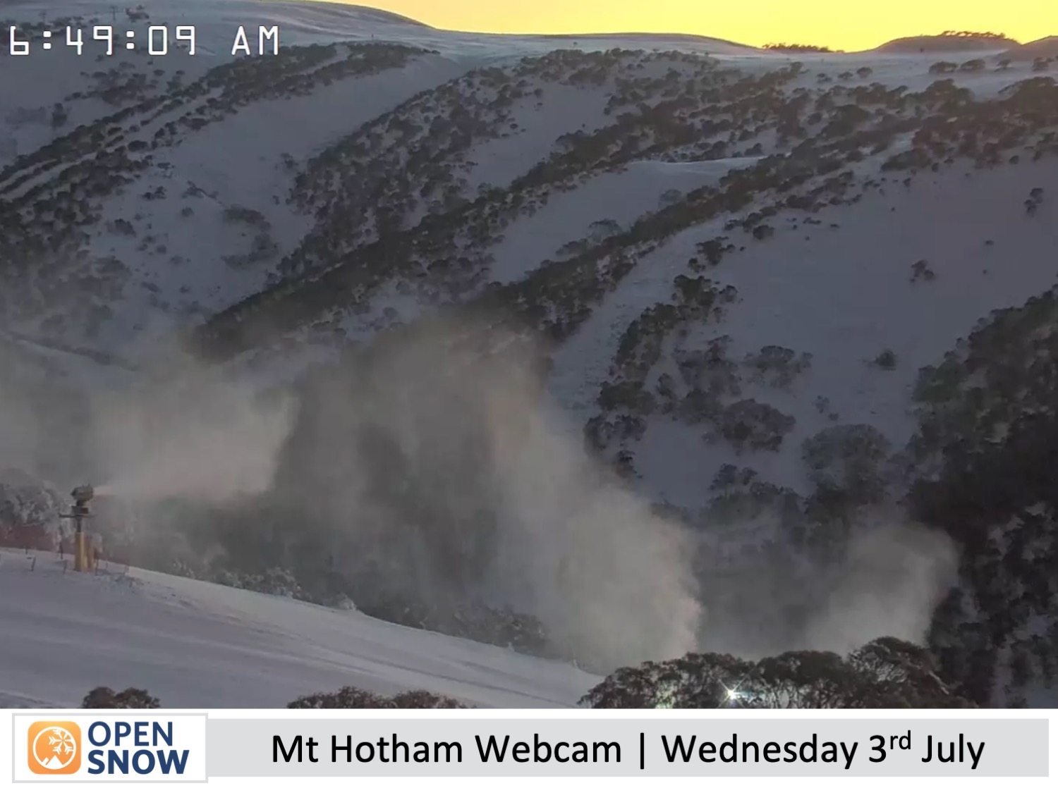
A storm at the weekend dropped around 20cm of fresh snow onto Australian ski resorts. Victorian resorts were on the winning side as a lot of that fell to base levels. However, in New South Wales temperatures were a little too warm and the lower slopes mostly just copped a whole lot of rain - nearly 55mm of it!
Since then the weather has been clear and the temperatures positively freezing, so a lot of man-made powder has also been added to the main runs, and with the groomers moving snow around, all of the resorts are looking great from top to bottom for the school holidays currently underway.
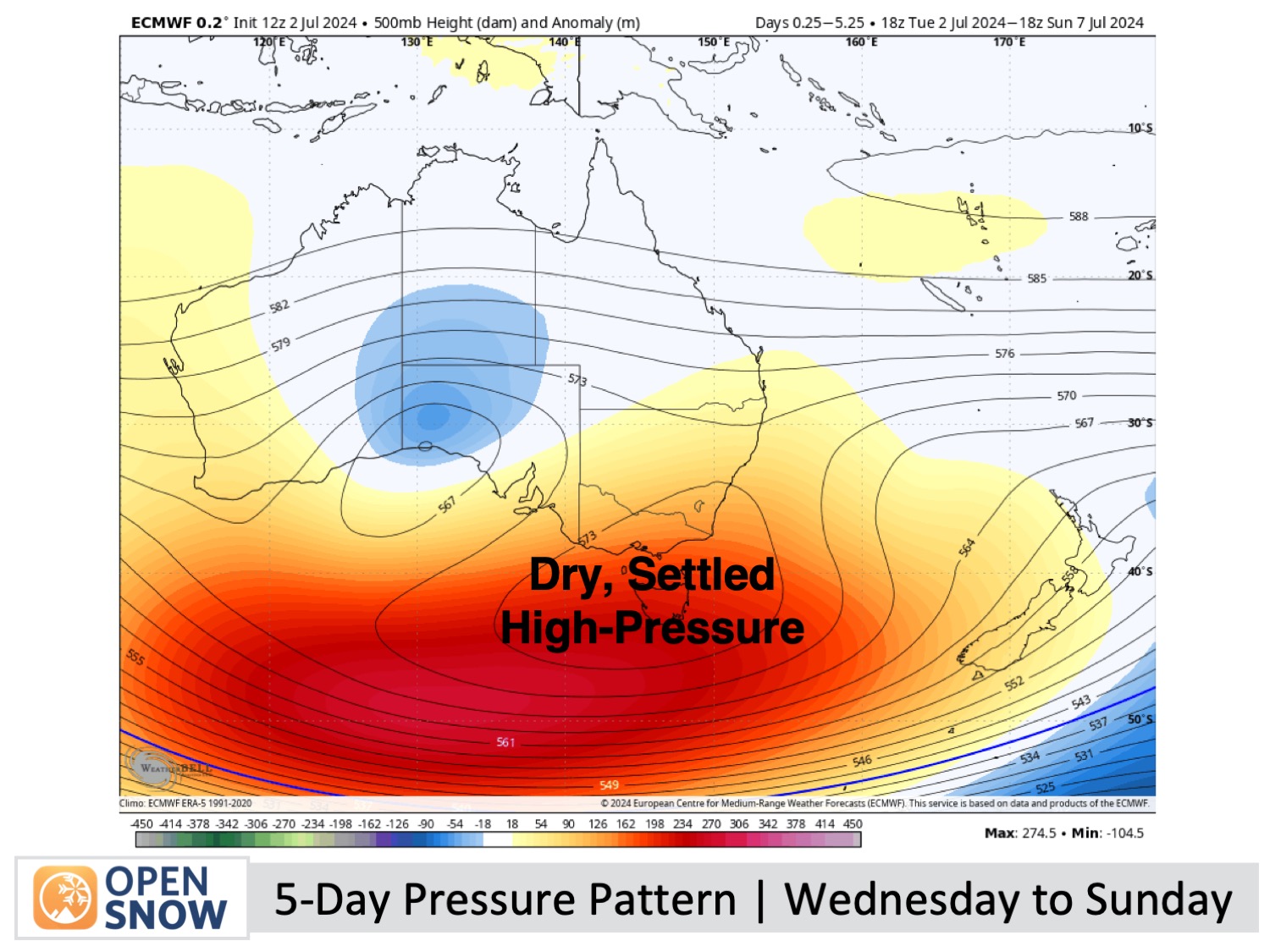
Forecast for Wednesday to Sunday (3rd to 7th July)
High pressure remains in control of our charts for the rest of the week, bringing mostly dry, sunny weather with light east-to-southeast winds.There are only a couple of minor caveats to this pattern:
- The east-to-southeast winds will pick up on Thursday, bringing in cloud and a little drizzle to some resorts (not likely for Mt Buller).
- Temperatures warm a little this weekend as winds gradually turn northerly. Until then, snowmakers will be able to keep the switch flipped on the snow machines and keep the groomed runs nice and chalky with fresh man-made powder.
Extended Forecast
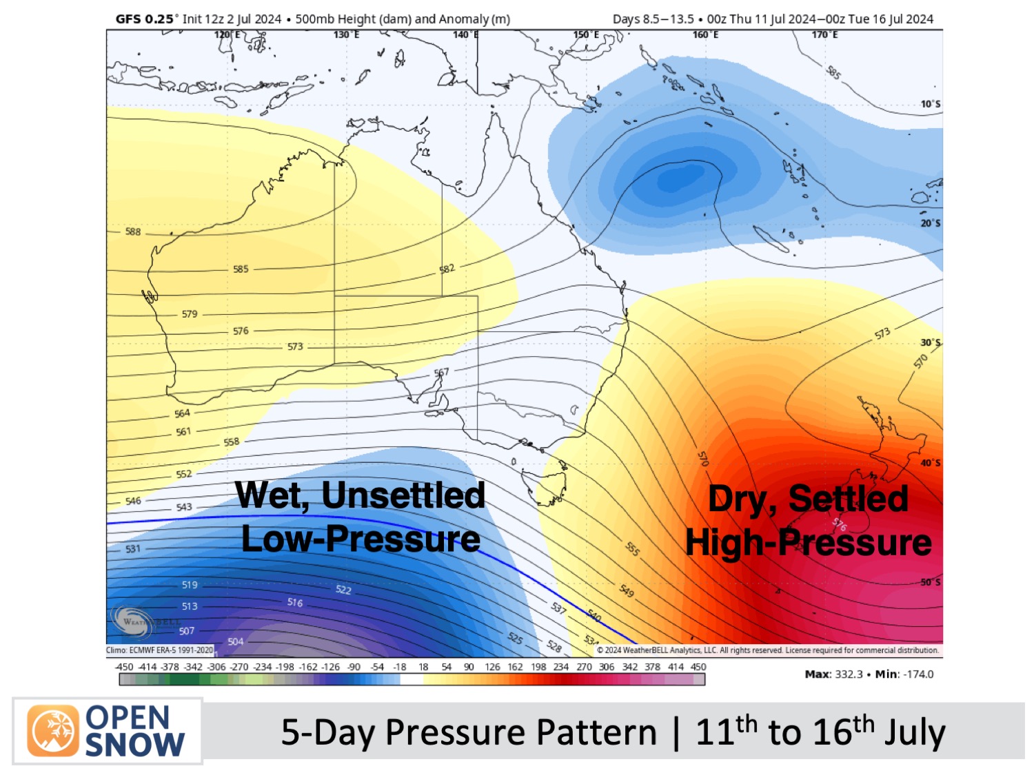
Next week, the weather is looking to become unsettled. First, a weak storm system may bring rain on Tuesday 9th and Wednesday 10th of July, with the possibility of snow on the higher slopes.
Then, a stronger storm is likely to arrive sometime around Thursday the 11th of July, with more rain expected over the following few days along with snow at higher elevations. Temperatures should cool off around Sunday 14th or Monday 15th of July, which will hopefully bring snow to lower elevations. This is still a long, long way off in forecast terms, so next week's forecasts should shed more light on this.
Thanks for reading. I'll keep these forecasts coming every Monday, Wednesday & Friday throughout the southern hemisphere season.
Mike O'Connor
About Our Forecaster


